EcoLur
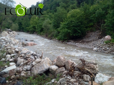
Paghjur River is the left tributary to the Aghstev River and flows in a distance of 41 km from its mouth. Paghjur River is 31 km, its total drainage basin is 207 sq. km. The river rises from one of the southern tops of Gugarats mountain range at height of 2119 meters, from the slope of Khan-Bulagh Mountain. The river basin is located in the eastern part of Armenia, the river flwo in north-west direction, its basin is located in Tavush Region, Armenia.
As of 1 January 2014, under the licenses issued by Public Services Regulatory Committee and the main indicators of small hydro power plants operated by hydropower companies, “Khachaghbyur HPP-1” SHPP is constructed on this river, which is operated by “Qarevard” LLC, derivation length - 2*1800 meters. The SHPP pipes a total river area of 3600 meters, which makes up 11.6129% of the river.
The amended version of “Khachaghbyur-2” SHPP has been presented to Environmental Expertise SNCO of Nature Protection Ministry, the public hearings of which were held on 17 February 2014. Under the project, the length of the pipeline is 3400 meters.
Thus, SHPPs will pipe a total length of 7000 meters of river territory, which makes up around 22․5806% of the river. Under EcoLur’s Ecological Risk Model, this indicator shows that the river will be in critical situation.
This material was made possible through the full support of Open Society Foundations – Armenia’s Policy Fellowship Program Initiative, grant number 18571. Ideas, thoughts, and arguments presented in the paper are the sole expression of the author’s views and do not reflect those of Open Society Assistance Foundations – Armenia.
April 08, 2014 at 10:56